- home
- Park & Nature
- Park
- Mountain Bukhansan Dulegil
Mountain Bukhansan Dulegil
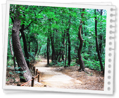
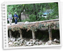
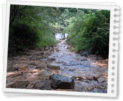
Dule-gil was created to provide a gentler slope around the Mt. Bukhan and it is located in the lower area with horizontal strolling area. It was made out of byroad areas and has twenty one themed roads; water road, dirt road, forest road, village road, strolling road and more. In Gangbuk-gu, there are four roads that are responsible for the residents’ rest and leisure.
Sonamusup-gil(Pine Tree Forrest Trail)

- Section : Ui, the entrance of Ui-ryeong, upper part of Pine Tree neighborhood Park.
- Distance : 3.1km
- Time : about 1 hour and 30 minutes
-
Difficulty
: low
The Magnificent and graceful shape looks as if the tree are the owners of the mountain. This place full of trees is spacious and gentle with slope, so it is perfect for strolling. -
Transportation
- Start : Suyu station exit No. 3, then take the bus No. 120 or 153 and get off at the last stop (5 minute walk)
- Finish : Suyu station exit No. 3, take the bus No. 120 or 153 and get off at the Deokseong Women’s University (5 minute walk crossing the street)
- Parking (Paid) : Inside Gangbuk-gu Towing Car Service (parking inside), 5-1 Ui-dong Gangbuk-gu Seoul (Tel: +82-2-944-3028)
Sulye-gil

- Section : Upper areas of the Pine Tree Neighborhood Park, entry area from the grave of Yi Jun patriot
- Distance : 2.3km
- Time : About 1 hour and 10 minutes
-
Difficulty
: low
Sulye-gil is where you can sense the spirit of independence because of the cemetery of the patriots who have contributed to the nation’s independence. -
Transportation
- Start : Suyu station exit 3, take the bus No. 120 or 153 and get off at the Deokseong Women’s University (5 minute walk crossing the street)
- Finish : Suyu exit 1, take Gangbuk local bus No. 1 and get off at the Unification Education Center
Huingureum-gil(White Cloud Trail)

- Sector : Grave of Yi Jun, the patriot, beginning of the Mt. Bukhan Eco Forrest
- Distance : 4.2km
- Time : About 2 hours
-
Difficulty
: Mid
After walking along the border of the Mt. Bukhan National Park with thick forest and a narrow trail, you can find the cloud observatory with 12m height. -
Transportation
- Start : Suyu station exit 1, Gangbuk local bus No.1 and get off at the Unification Education Center
- Finish : Gil-eum station exit 3, and get off at the last stop by bus No. 1014 and 1114
Ui-ryeong gil

- Sector : Gyohyeon, entry area of Ui-ryeong gil- Ui Ui-ryeong gil
- Distance : 6-8km
- Time : About 3 hours and 30 minutes
-
Difficulty
: Mid
Ui-ryeong (Cow Ear Hill) gil is a small road that connects Ui-dong of Gangbuk-gu Seoul and Gyohyeon-ri of Yangju city of Gyeong-gi Providence, and borders between the north of Mt. Dobong and south of Mt. Bukhan. -
Transportation
- Start : Gupabal station exit 1, take the bus No. 704 or 34 and get off at the Seokgulam (5 minute walk)
- Finish : Suyu station exit 3, take the bus No. 120 or 153, and get off at the last stop (20 minute walk) Anti tank obstacles, Security Experience Center, Obong Observatory, Ui/Gyohyeon Visiting Center
You can visit the Ui-ryeong gil by making a reservation. (Previous reservation with an ID Card is a must.)
-
Telephone
: Only for visitors over 65 years of age and older and foreigners
- Gyohyeon Visiting Center : 031-855-6559
- Ui Visiting Center : 02-998-8365
- Website : Mt. Bukhan National Park
- Website : Mt. Bukhan’s Dule-gil

